Community Infrastructure
The community infrastructure area within the IfSC focuses on creating innovative ways for addressing infrastructure problems in local communities. Housed within the College of Engineering, our work is interdisciplinary in nature and spans across multiple infrastructure systems (e.g., water, stormwater, transportation, buildings). These systems are essential for the wellbeing of local communities.
Discovery Initiative Highlights
Citizen Science for Infrastructure Monitoring at the Neighborhood Level
Lead: Dr. Nasir Gharaibeh
In the pursuit of safe and reliable infrastructure systems, monitoring data are collected to assess the condition, usage, and in-service performance of these systems. For large-scale infrastructure, monitoring data are often collected using a variety of sensor technologies and periodic field inspections. For neighborhood scale infrastructure, however, these data remain limited in both quantity and quality. Through support from the National Science Foundation, fundamental research is being pursued in this project to design and test protocols and tools for collecting infrastructure monitoring data at the neighborhood level by volunteer citizen scientists, with focus on stormwater infrastructure. This research will advance the scholarly momentum of an interdisciplinary team of investigators from civil engineering, urban planning, sociology, and public health to better understand how and when to engage members of the general public in collecting infrastructure monitoring data.
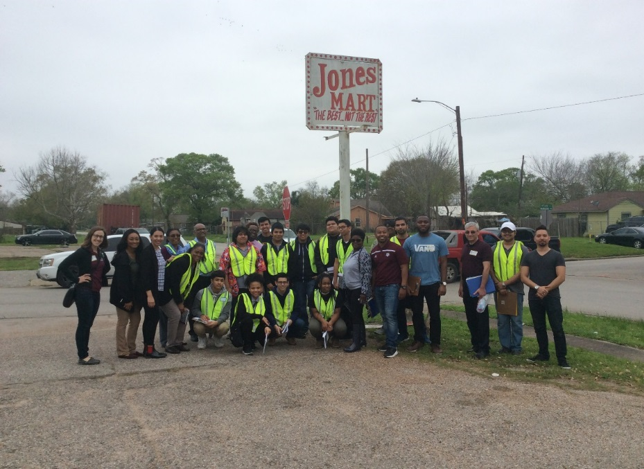
Field trials are now being conducted in vulnerable neighborhoods with a long history of flooding and environmental issues in the Houston metropolitan area. The field trials include the collection of observational data (collected by high school students citizen scientists), measurement-based data (collected by engineering professionals), and feedback data (gathered through workshops and a closing questionnaire). The engineering professionals will use a mobile laser scanning and camera unit to collect the measurement-based data (e.g., location, geometry, and condition of stormwater drainage assets). Through an iterative process, we will identify the methodological issues in citizen science data (as they apply to stormwater infrastructure monitoring) and maximize the fidelity of the protocols and tools.
Effect of Urbanization on the Streamflows and Floodplain of the Sims Bayou Watershed in Houston, Texas
Lead: Dr. Francisco Olivera
Increases in impervious cover because of urbanization have been associated with increases in runoff generation and, in extreme cases, flooding. In this project, we studied the evolution of land development, impervious cover, annual runoff volume, annual peak flow and floodplain extent in the Sims Bayou watershed in the 1980 – 2000 period. The Sims Bayou watershed in south Houston, like many other areas in Houston, is somewhat flat and impervious. Using parcel data provided by the Harris County Appraisal District and Fort Bend Central Appraisal District, the evolution of land use was tracked based on the year of construction of the parcels. Corrections to the parcel data were needed in some cases to account for mismatches between the data and aerial photography. It was found the impervious cover fraction evolved from 15% in 1980 to 18% in 2000, which is significantly above the recommended 10% documented in the literature. Hydrologic and hydraulic analysis was conducted using HEC-HMS and HEC-RAS models developed by the Harris County Flood Control District. It was found that, statistically speaking, annual runoff volumes increase over time, while annual peak flows do not. This unexpected result is explained by the fact that the increase in annual runoff volume is associated to small storm event that, under previous levels of impervious cover, did not generate runoff. It was also observed that, despite the annual peak flows did not statistically change, their variability increased, leading to more severe, although less frequent, potential flood events. It was found that, because of development in the 1980s and 1990s, around 3,500 homes were added to the 100-yr floodplain. It was concluded that, although precipitation has increased in recent years, a fundamental part of the flooding problem in the Sims Bayou watershed has been caused by urbanization in two forms: (1) increase in impervious cover, and (2) development of areas already within the 100-yr floodplain. Granting development is needed to accommodate population and employment growth, the negative consequences to people and the built environment can be devastating. Local government implementation of low-impact development policies, that reduce the effect of urbanization on the watershed’s hydrology and hydraulics, is indispensable if these negative effects are to be reduced.
Development in 1940
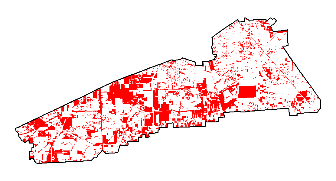
Development in 1980
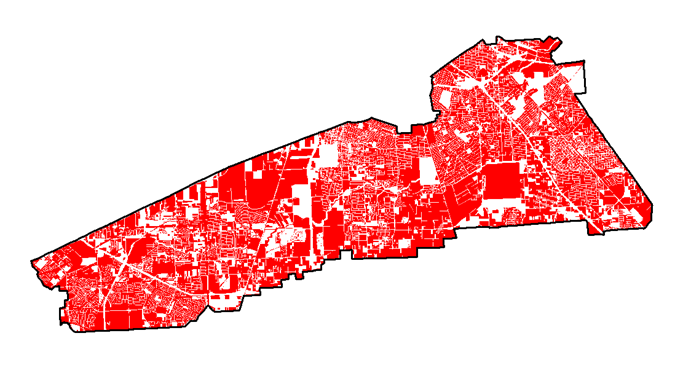
Development in 2000

Resilient Urban Water Infrastructure
Lead: Dr. Ali Mostafavi
As part of the National Science Foundation (NSF) Urban Water Innovation Network (UWIN), Dr. Mostafavi is leading a project focusing on the resilience of coupled human-infrastructure systems. On the supply side, the objective of this study is to analyze the long-term resilience of urban water infrastructure systems under different stressors (e.g., climate change impacts, population growth, and aging infrastructure). On the demand side, the study investigates the fundamental mechanisms affecting the water conservation technology adoption by residential consumers. The study adopts a complex systems approach and utilizes Agent-Based Modeling for theory building.
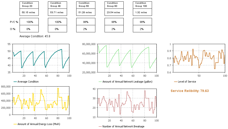
Model Output: Long-term Performance of Water Distribution Networks