Education
The Institute for Sustainable Communities is dedicated to placing Texas A&M University students into experiential educational research projects as well as providing expertise and training opportunities to communities across Texas.
Involving Communities
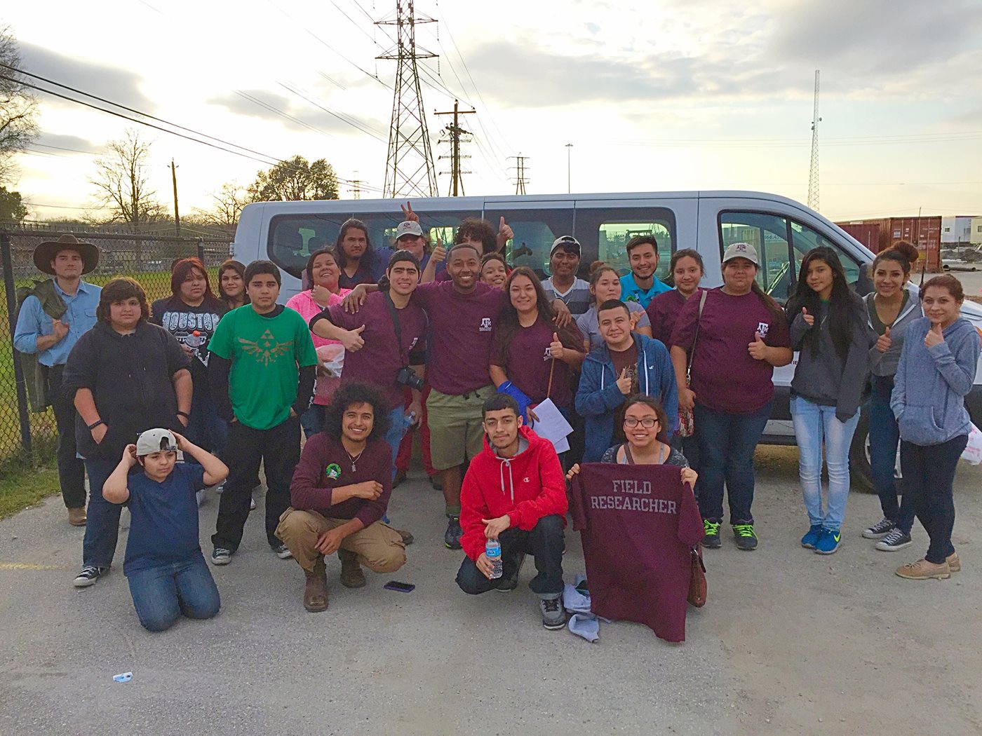
Our research endeavors depend upon the assistance of our partners within the community and allow for an opportunity to collaborate with residents and local stakeholers for participatory research programs. The Environmental Grand Challenge has a standing slot at Furr High School during their “Genius Time” program that offers training opportunities to create citizen scientists and promote the university to interested students. Community presentations have occurred in the neighborhoods of Manchester and Sunnyside in Houston to discuss research results and explain environmental conditions to interested members.
Student Opportunities
The Institute for Sustainable Communities offers undergraduate and graduate students opportunities for active learning pursuits from courses as well as extracurricular research activities within each Discovery Initiative. Courses in the Department of Landscape Architecture & Urban Planning offer semester-long opportunities, student researchers at the School of Public Health engage in community endeavors within our living laboratories, and course projects from the Department of Sociology, Department of Civil Engineering, and Department of Geography offer opportunities for personal and professional development.
Below are a selection of previous, current, and ongoing projects led by student researchers.
Student Project Highlights
Marccus Dwayne Hendricks - Current Doctoral Student
Infrastructural Justice: The Participatory Planning and Provision of Critical Infrastructure towards Environmental Justice and Resiliency
Exposure to environmental hazards for communities around the country are a direct implication of the nature of public critical infrastructure. The planning and management of critical infrastructure at the neighborhood level presents key concerns for equity, social vulnerability, and environmental justice; for public decisions regarding the distribution of infrastructure affect people’s lives in integral ways. Therefore, this research builds off existing partnerships with local community groups to develop and pilot a participatory infrastructure assessment tool that can provide empirical data through citizen science for the condition of critical infrastructure at the neighborhood level. Preliminary results indicate that citizen science data for infrastructure assessment can be valid and reliable in producing data that can be used to inform planning. Participatory planning and provision of critical infrastructure can transform existing conditions and advance policies and programs that redistribute public resources towards justice and resiliency for historically disenfranchised communities.
Garett Thomas Sansom, MPH, DrPH - Former Doctoral Student
Assessment of Community Health and Environmental Risk Perceptions in the Neighborhood of Manchester, Houston, TX.
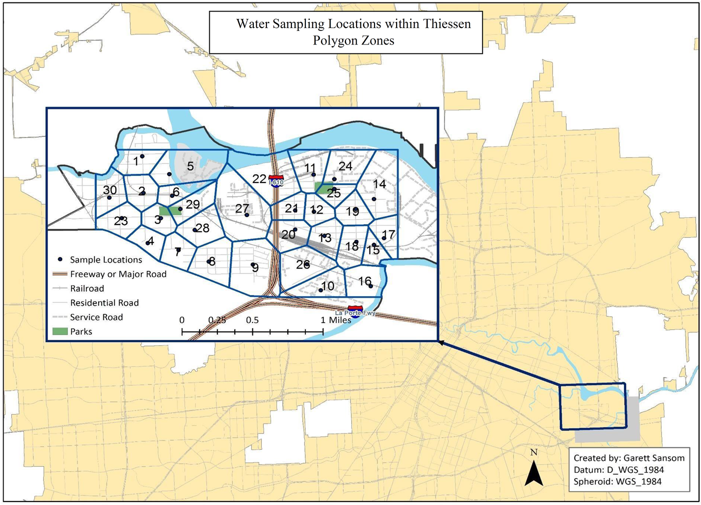
This project explored three main dimensions: to assess if community members can accurately predict areas of poor environmental conditions, to better understand differences in perceived environmental health risks among racial groups, and to assess the impact of time lived in a community with environmental justice issues concerning mental and physical health. A cross-sectional study was conducted and survey data was collected from residents of Manchester, a small neighborhood in Houston, TX. Water sampling was conducted in thirty zones within the neighborhood. Our survey (N=109) utilized questions around perceptions of environmental risk as well as the 12 item Short Form Health Survey version 2 (SF12v2) to assess the general mental and physical health of the community. The community as a whole had reduced physical health scores compared to the national average in the U.S. There was also a correlation between the time residents had lived in the neighborhood and a reduction in their physical health scores, after adjusting for age, race, and gender (coef=-0.27, p-value <0.001). Water sampling showed elevated levels of heavy metals in the surface water sampling, confirming the concerns of the community collected through neighborhood outreach programs. This project shows some evidence that racial differences in perceived environmental harm are either reduced or reversed when environmental conditions are taken into account. It also suggests that when looking at macro-level conditions in this community, physical health can be negatively impacted simply by the length of time spent in the neighborhood.
These findings were published through the
International Journal of Environmental Research and Public HealthLeslie Andrea Munoz Ordonez, MS - Former Master of Science Student
The Effect of Urbanization on the Streamflows of the Sims Bayou Watershed
 Several studies have linked urbanization with increased runoff volume and peak discharges. Although attempts at solutions have been made to mitigate the impact of flooding, increasing development in the area may be hindering those efforts. This research study analyzes the flows and urbanization in the watershed through time to detect any trends. Annual peak flows and average daily flow records for two gages within the Sims Bayou watershed were analyzed. Yearly development maps were developed using GIS. A yearly percent watershed developed value was then used to compare with the trends in flow. Since a positive relationship was observed between flows and urbanization for the selected gages, HEC-HMS was used to simulate the effect of urbanization alone on the watershed. By altering development values to reflect a development percentage similar to that occurring in the watershed in 1980, 1990, and 2000, the amount of runoff from the watershed for a 1% exceedance probability storm for development levels of 1980 and 2000 were compared. Changing development levels from 1980 to 2000 produced a 5% change in discharge at the watershed outlet. A model was used to assess the impact of such changes on flooding risk for residents of the Sims Bayou watershed. Regulatory floodplains for development levels similar to those in the watershed for 1980, 1990, and 2000 were mapped and compared. The increase in floodplain area resulting from changing development levels was approximately 15%.
Full thesis can be viewed
here.